
Find Shrewsbury Streets by Address
A Shrewsbury street search works best as a short chain, not as a roster. Start with the current address in the town parcel layer and keep the site address, street string, parcel key, plan reference, and ZIP together. Those fields describe a mapped Shrewsbury parcel. Next, use the book and page or related plan reference to locate the land instrument at the Worcester Registry. If a question concerns a current civic record, ask the Town Clerk about the permitted route instead of treating a parcel result as proof of residence. Historical names need their own dated source.
- Locate the current Shrewsbury address in the parcel layer and record
SITE_ADDR,FULL_STR,MAP_PAR_ID,PROP_ID,PLAN_ID, and ZIP. - Read
OWNER1and the owner mailing fields as property-record data. A Shrewsbury mailing address, a deed grantee, and a current resident are separate facts. - Carry
LS_BOOKandLS_PAGEto the Worcester Registry of Deeds, then review the recorded instrument and its prior reference. - For an older Shrewsbury trail, use the pre-1960 Grantor and Grantee books and then the unindexed-property images, rather than relying only on a current name search.
- Use the Town Clerk, library holdings, or a narrow records request for the specific public record needed. Keep the source year next to each result.
That sequence prevents a common Shrewsbury error: converting a property clue into a claim about every household member. It also makes the next search reproducible when a street name, plan, or owner record changes.
Read Shrewsbury Street Parcel Fields
The official Shrewsbury FY2025 parcel service is the clearest address-keyed source located. It joins polygon geometry to an address, an owner mailing record, assessment fields, and Registry pointers. Its metadata says the geometry and attributes were updated using FY2025 Assessor CAMA data and Worcester South Registry plans. The service is a strong starting place because it exposes the exact field names, but it remains a current map and assessment record rather than title proof or a list of people at an address.
| Shrewsbury field | Use in an address search | Important limit |
|---|---|---|
SITE_ADDR and FULL_STR | Current situs address and street string | Current wording may not match an older deed description. |
MAP_PAR_ID and PROP_ID | Parcel and map references | They identify land records, not a household. |
OWNER1 and OWN_ADDR | Owner and owner mailing record | A mailing address may be outside Shrewsbury. |
LS_BOOK, LS_PAGE, and PLAN_ID | Bridge to deed and plan research | They point to a record; they are not the deed image. |
ZIP | Postal check alongside the address | Postal geography does not set a parcel boundary. |
The documented Shrewsbury sample at 27 Colonial Drive shows why the distinctions matter: the parcel has a Shrewsbury situs address, while its owner mailing fields point to Worcester and its owner field names an organization. Use that as a data-quality lesson, not as a shortcut to infer occupancy.
- Parcel
- A mapped unit of land identified by a local map or parcel key.
- Situs address
- The physical location assigned to the parcel, kept separately from a mailing address.
- Plan
- A recorded drawing or reference that can help connect lot lines, bearings, and descriptions.
- Criss-cross directory
- A historical directory arranged by address, useful for dated household research when a collection actually supplies it.
Compare Shrewsbury Street Records
No Shrewsbury street directory is a single official roll. A Shrewsbury street directory search draws on address-keyed sources that each answer a narrower question. The town GIS identifies a current parcel and holds references that can lead outward. The Assessor’s public property-search route provides assessment context. Worcester Registry instruments document recorded land transactions. The Town Clerk is the local access point for annual street-list questions, election administration, and municipal records subject to their rules. A permit record adds project context, not a verified list of people at a property.
| Address record | Shrewsbury or Worcester keeper | What it can establish | Access route |
|---|---|---|---|
| FY2025 parcel layer | Shrewsbury GIS and Assessors | Parcel, situs, map key, owner mailing fields, deed pointers | Official parcel service |
| Assessment card | Shrewsbury Assessors | Assessment and property-detail context | Assessor department |
| Recorded deed or plan | Worcester District Registry of Deeds | Recorded parties, instrument, book/page, plan, and chain references | MassLandRecords |
| Annual street list or voter record | Shrewsbury Town Clerk | Only the public fields and access allowed by law | Town Clerk |
| Permit file | Shrewsbury department of record | Project, address, permit number, date, and status where public | ViewPoint Cloud |
Use the source closest to the fact. A Registry instrument is the source for a recorded land fact. The Shrewsbury GIS layer is the source for a current mapped attribute. A Clerk record is the local source for a municipal record. Combining them too early creates false certainty.
Use Shrewsbury Street GIS
Shrewsbury has more than 13,000 parcels and the Assessors Department provides a public property-search route as well as CAMA-based assessment work. Start with the Shrewsbury GIS portal when you need to see the polygon and nearby street pattern. The REST layer is especially useful for checking field labels such as SITE_ADDR, FULL_STR, ZIP, MAP_PAR_ID, LS_BOOK, and LS_PAGE. The town’s map tells you what the current service stores. It does not settle title, present use, or residence.
Massachusetts Interactive Property Map is a statewide boundary fallback. Its Property Information Finder is address-oriented and does not replace the local Shrewsbury source for detailed parcel fields. The distinction keeps a street search grounded in the right system: use the Shrewsbury layer for local attributes, the state map for a broad visual check, and the Registry when a recorded instrument is needed.
The statewide map’s property-information page documents an address-oriented fallback for a Shrewsbury parcel search. It is useful for checking those limits before shifting back to the detailed local layer.
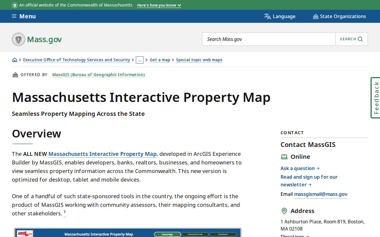
The image reinforces that a visual parcel lookup is a starting point. The Shrewsbury record chain still needs the local fields and, when necessary, the underlying Registry document.
Check Shrewsbury Street Assessors
The Shrewsbury Assessors Department is the appropriate contact for assessment questions and the public property-search route. Its published contact details include 508-841-8501 and assessor@shrewsburyma.gov. The research did not capture a complete live VGSI field list, result pagination, or export controls. For that reason, use the documented FY2025 layer fields when describing a repeatable street search, then verify a value or card detail with the Shrewsbury office or the live property-search result.
The Assessor Department page pictured here establishes the town department and property-search context. It is not an image of a deed, a directory entry, or an occupancy record.
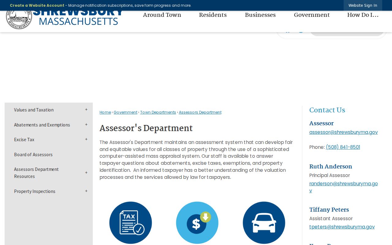
For a Shrewsbury address, retain the fiscal year and retrieval date beside any assessment value. Shrewsbury parcel attributes change, and the book/page bridge should be checked against the Registry instrument rather than copied forward as a conclusion.
Follow Shrewsbury Street Deed Pointers
Shrewsbury does not send land research to a county-government recorder. Worcester County government was abolished in 1998; Shrewsbury land documents are recorded through the Worcester District Registry of Deeds, a state constitutional recording office. The Registry serves Shrewsbury and makes current Recorded Land and Registered Land searching available through MassLandRecords. Its online workflow is strongest for the post-1960 period. It is not a census of residents, even when a deed includes a party name and a town.
For a Shrewsbury instrument after the modern index boundary, search by the known address, book/page, document number, property, party, or recorded date as the portal allows. Record grantor, grantee, document type, town, book/page, document number, recorded date, and image availability. Follow the prior reference in the instrument. For the pre-1960 period, the Registry’s search instructions route researchers to scanned Grantor and Grantee books, then to unindexed-property images. That transition is crucial because older search paths can look empty when a current search mode is used alone.
Note: A current Shrewsbury parcel’s book and page are a bridge to a Registry reference, not the deed image itself.
Inspect Shrewsbury Street Parcel Metadata
The official Shrewsbury parcel service exposes a reproducible schema rather than only a map display. It stores Shrewsbury address strings, owner and mailing attributes, mapped IDs, assessment fields, land-sale references, zoning, use, and building attributes. The service supports query and export formats and has a stated maximum record count of 2,000. Those are service facts, not permission to turn an export into a people list. The safe address use is narrow: identify the particular Shrewsbury parcel, compare the relevant fields, and move to the record custodian for any document question.
The Shrewsbury FY2025 parcel-service metadata is captured below. It is the source for the named field vocabulary used in this Shrewsbury street directory.
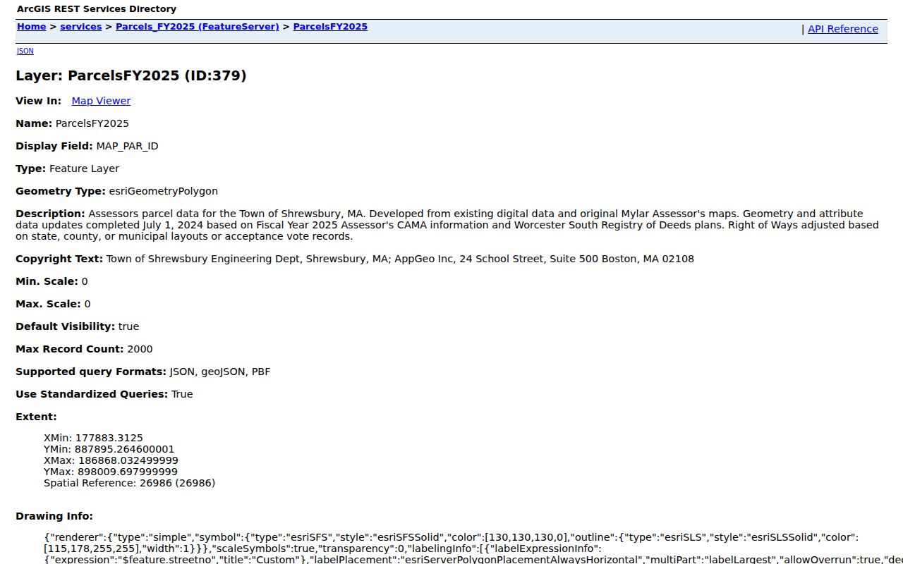
The captured schema makes it easier to compare a current SITE_ADDR with FULL_STR, the map key, owner mailing fields, and LS_BOOK/LS_PAGE before looking up a Shrewsbury Registry record.
Verify Shrewsbury Street Geography
Postal, municipal, parcel, and precinct lines do different work in Shrewsbury. ZIP 01545 is the principal Shrewsbury residential-delivery ZIP. ZIP 01546 is associated with the Central Massachusetts Processing and Distribution Center at 192 Main Street and is not an ordinary residential-delivery neighborhood. A ZIP result therefore needs a second check against the current Shrewsbury address and parcel rather than a quick geographic label.
The official town map shows ten Shrewsbury precincts and boundaries with West Boylston, Boylston, Northborough, Worcester, Westborough, and Grafton. A precinct can help with civic geography, while the GIS record anchors a parcel. Neither one makes a mailing address proof that someone lives there. This is especially important when a Shrewsbury street touches a boundary or when an older source uses a route, post office, lot, or former road description instead of a modern ZIP.
Keep Shrewsbury Street Permits
Shrewsbury permit systems can add a dated property or project clue. The town’s building route uses ViewPoint Cloud and moved paper processing online in September 2011. The available research identifies project details, uploads, real-time status, comments, approvals, and example permit numbers such as R-22-XXXXX and C-22-XXXXX; it does not document a complete public-search schema. Shrewsbury DPW and health routes have their own systems and records. Treat each Shrewsbury permit as a property or project record and cite its number, date, and source.
If the record is not visible online, ask for the specific public portion through the appropriate Shrewsbury office. A permit can clarify work at an address, but it cannot establish a household roster or be used to reconstruct protected contact information.
Trace Shrewsbury Street History
For former Shrewsbury street names or lot descriptions, compare the current parcel with a Registry plan, town meeting road-layout material, Engineering acceptance records, and local-history sources. The research did not locate an official Shrewsbury street-renumbering or renaming schedule. Mark that Shrewsbury gap rather than guessing that an older address uses today’s street number. Plan bearings, lot numbers, adjoining owners, and landmarks can provide the necessary bridge when a title description no longer matches the current map label.
The Shrewsbury Public Library’s Ward Room and genealogy resources offer town reports, local histories, maps, newspapers, and research support. Historical address work benefits from dated directory material, but it should not be converted into a current street directory. When the question shifts from a present parcel to past household placement, the Shrewsbury Directory Book offers the separate historical-collection path.
Request Shrewsbury Street Records
Massachusetts Public Records Law is principally M.G.L. c.66, §10 and 950 CMR 32.00. For a Shrewsbury street record that is not already public online, make a narrow request that names the department, date range, street or parcel identifier, desired record type, and preferred format. Shrewsbury’s primary Records Access Officer is Town Clerk Sharyn Thomas at 100 Maple Avenue, 508-841-8507, sthomas@shrewsburyma.gov. An initial response is generally due within ten business days, though a request can involve clarification, an extension, fees, redaction, or review by the Supervisor of Records.
Ask for existing, publicly disclosable records and request segregable portions where appropriate. For example, a request may identify a Shrewsbury parcel, a specified year range, and public permit number, issue date, description, and final status. It should not ask the town to create a new dossier or disclose protected personal fields.
Note: Shrewsbury public-records requests work best when the parcel key, street address, record series, and date range are all stated plainly.
Set Shrewsbury Street Directory Limits
A Shrewsbury street directory built from public records cannot show a complete or current list of people who live along a road. A parcel owner may not be the person at the situs address. An owner mailing address may be elsewhere. A voter-list omission may reflect timing, inactive or confidential status, or another lawful exclusion. A permit applicant, business filing, court result, or license address has its own meaning and should not be converted into a residence claim.
Massachusetts protections include the Address Confidentiality Program, confidential-voter rules, vital-record restrictions, and sealed or impounded court matters. A public search must never try to reverse an ACP substitute address or another protected address. For a Shrewsbury result, match records using independent, lawful identifiers and label a map field, index entry, image, or request response for what it is.
Lawful use. Use Shrewsbury address records for lawful personal research, property history, and civic transparency. Do not use a street search to stalk, harass, harm, or work around a protected address.