
Shrewsbury ZIP Coverage
Postal information for Shrewsbury needs one important distinction. The official delivery ZIP for ordinary town addresses is different from the code used by a mail-processing facility. The USPS preferred-city list also associates 01520, 01522, and 01545 through 01546 with the SHREWSBURY MA postal label. That label is for postal naming, not evidence that every listed ZIP is a Shrewsbury delivery neighborhood or that a person lives in town.
| ZIP | Areas covered | Post office | Notes |
|---|---|---|---|
| 01545 | Principal Shrewsbury residential and delivery addresses | Shrewsbury Post Office, 43 Maple Avenue | Standard delivery ZIP; the town also lists Annex and Turnpike stations. |
| 01546 | Central Massachusetts Processing and Distribution Center | 192 Main Street facility | Unique facility ZIP, not an ordinary residential neighborhood. |
| 01520 and 01522 | Appear with the preferred-city label in USPS postal naming material | Use USPS address validation for a specific address | Postal naming alone does not establish local delivery or municipal location. |
Use the postal directory as a starting point, not a list of households. A parcel has its own situs, town, map, and deed-reference fields. A mailing label has a different job. When the purpose is a street-by-street address trail, use the Shrewsbury Street Directory after the ZIP has narrowed the address.
Shrewsbury ZIP Postal Stops
The official Shrewsbury post-office locations page identifies the main office, the Shrewsbury Annex, and Turnpike Station. The main Shrewsbury Post Office is at 43 Maple Avenue, Shrewsbury, MA 01545-9998, phone 508-842-0243. Published retail hours are Monday through Friday, 8:30 to 5:00, and Saturday, 9:00 to noon. The Annex is at 194 Main Street, 01545-8194, and Turnpike Station is at 166 Boston Turnpike, 01545-9991.
Main postal office
43 Maple Avenue
Shrewsbury, MA 01545-9998
508-842-0243
Other town stations
Shrewsbury Annex, 194 Main Street
Turnpike Station, 166 Boston Turnpike
The town’s postal-locations page documents the local stations used in this postal resource.
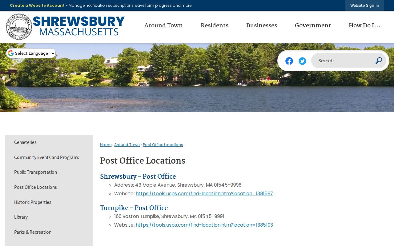
Station information helps confirm a postal service point. It does not determine a parcel boundary, voter precinct, or residence.
The official USPS Shrewsbury location record supplies the delivery-office information used here.
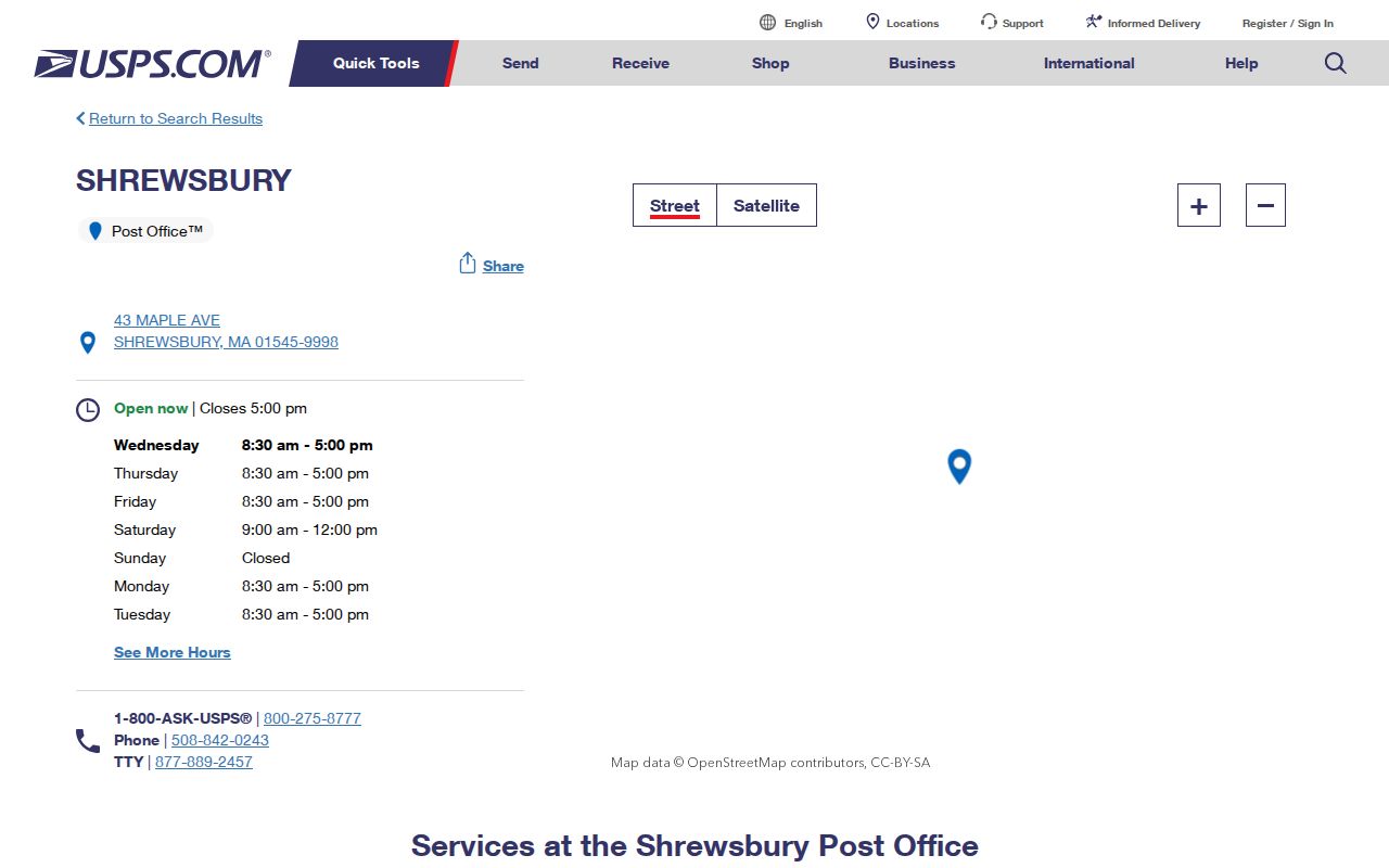
Check the live postal record for current service details before relying on a ZIP or station listing.
Shrewsbury 01546 Postal Facility
The 01546 ZIP belongs to the Central Massachusetts Processing and Distribution Center at 192 Main Street. USPS facility material identifies it as the 101 Central Mass MA P&DC. This makes 01546 a unique facility ZIP, not a general-purpose delivery area for a Shrewsbury neighborhood. A search that turns up 01546 should be checked before it is placed in a resident or address timeline.
The official USPS label list supplies postal preferred-city mapping, but it does not override the purpose of the processing-center ZIP. A preferred city is the label USPS favors in an address. It is not a municipal boundary finding.
Facility check. Before treating a 01546 result as a person or property address, confirm whether it refers to the Central Massachusetts processing facility.
Shrewsbury ZIP Parcel Fields
The official Shrewsbury FY2025 parcel service can return or filter records by ZIP while retaining address, owner, map, sale, plan, and deed-reference information. It is the local route for ZIP-granular parcel context. The statewide Massachusetts Interactive Property Map offers a visual fallback across all 351 municipalities, but its Property Information Finder is address-oriented and does not provide owner-name searching.
| Parcel field | What the field supplies | Search caution |
|---|---|---|
| ZIP | Postal ZIP stored with the parcel record | Use with CITY and street fields, not as the only geography. |
| SITE_ADDR and FULL_STR | Situs address and street string | A situs is the parcel location, not a roster of occupants. |
| CITY | Municipal locality stored in the parcel data | Compare it with the postal formatting when lines conflict. |
| OWNER1 | Listed owner name or entity | An owner can be an organization and is not necessarily an occupant. |
| MAP_PAR_ID and PROP_ID | Parcel and map keys | Keep these keys with the record date for later checking. |
| PLAN_ID, LS_BOOK, LS_PAGE | Plan and Registry bridge references | They point to a deed or plan; they are not the instrument image. |
The local layer reports FY2025 data and supports query and export, with a maximum record count of 2,000. Parcel geometry and attributes were updated using FY2025 assessor information and Registry plans. Assessment fields and parcel attributes change, so preserve the fiscal year and retrieval date with any search result.
Find Records by Shrewsbury ZIP
ZIP searching is strongest when the question is about parcel geography. Validate the address with USPS first, then use the local GIS service to compare its ZIP, city, site address, and parcel key. The town GIS portal also carries voting and precinct mapping, which answers an election geography question rather than a postal one. A local voter list is requested through the Town Clerk and has statutory exclusions; the state voter tool is an individual status lookup that requires a five-digit ZIP, not a statewide resident directory.
- Use the USPS Shrewsbury location page or address service to verify the delivery ZIP and format.
- Query the Shrewsbury parcel layer by ZIP and retain SITE_ADDR, CITY, MAP_PAR_ID, and any book or page reference with the result.
- Check the Shrewsbury GIS portal when the question is precinct or town geography.
- For an individual’s own voting status, use the state tool with the required name, birth-date, ZIP, and acknowledgement. Ask the Town Clerk about a lawful municipal-list request.
Do not treat a ZIP-wide parcel result as a list of people. It can give a property record and mailing or owner fields, but the source itself warns that an owner is not necessarily an occupant.
Note: Save the ZIP with the town and site-address fields so a later search can distinguish postal and parcel geography.
Shrewsbury Postal Boundary Limits
Postal, municipal, parcel, and election lines do not use the same map. The official 2021 Shrewsbury map shows ten precincts and adjoining West Boylston, Boylston, Northborough, Worcester, Westborough, and Grafton. A Shrewsbury mailing label can therefore answer a different question than the town boundary or a voting precinct. Search both the town name and ZIP for an address reconciliation, then preserve the USPS-formatted address separately from the parcel’s municipality field.
- ZIP versus ZIP+4
- The five-digit ZIP identifies a postal delivery area. ZIP+4 adds a delivery segment or facility detail and is not a neighborhood name.
- Unique ZIP
- A code assigned to a particular organization or facility, such as the 01546 processing center.
- Postal preferred city
- The place name USPS prefers in an address label; it does not decide city or town jurisdiction.
- Carrier route
- A postal delivery grouping used for mail operations, not a municipal boundary.
Boundary check. Use USPS for delivery facts, the parcel layer for parcel facts, and the official town map for municipal or precinct context.
Shrewsbury ZIP and Precinct Geography
Shrewsbury’s ten precincts are a useful civic geography, but they should not be renamed as ZIP areas. The town’s election guidance directs residents to the GIS portal’s Voting tab for precinct information. That recent workflow keeps precinct lookup with the local map rather than a static postal source. Postal routes can cross the same broad area while parcel boundaries and election lines follow other patterns.
This difference matters when comparing records. A delivery ZIP may help find the correct parcel group, while a precinct may help identify the proper election context. Neither field establishes where a person currently lives. For family history, use the date-specific record and map that match the period being researched.
Shrewsbury Postal Records Before ZIPs
Older Shrewsbury deeds, town reports, directories, and postal material predate modern ZIPs. Search historical sources by town, street, post office, route, county, lot description, or adjoining owner instead of forcing a current delivery field onto an old entry. The Shrewsbury Public Library genealogy collection holds local histories, town reports, maps, photographs, and town records. Its Ward Room is usually locked, so arrange access with the Reference Librarian.
Where a historic address changes form, pair the older street or lot description with a Registry book and page, plan, or town record. The post-1960 Registry search and older grantor-grantee books have different workflows. The postal directory is useful for the present delivery layer, while a historical address trail needs the period’s own names and record systems.
Use Shrewsbury ZIPs Carefully
A ZIP is a useful filter, not a shortcut around record limits. Keep owner, mailing address, parcel situs, and occupant concepts separate. Do not turn a unique facility code into a neighborhood, and do not turn a preferred-city label into proof of a town boundary. When a map or search result conflicts, contact the office that owns the relevant record type or send a focused request through the town’s public-records route.
Massachusetts Public Records Law, M.G.L. c.66, §10 and 950 CMR 32.00, permits requests for existing records subject to exemptions and redactions. An initial response is normally due within ten business days. Describe the town department, date range, street or parcel, record type, and desired public fields so the Records Access Officer can identify the correct material.
Record the retrieval date because postal service details, parcel data, and GIS layers can change over time.