
Locate Shrewsbury Neighbors
For an immediate Shrewsbury block, begin with the parcel polygon map and restrict the question to adjoining or nearby parcels. The official GIS layer can show the current situs address, parcel identifiers, owner and owner mailing fields, map references, and Registry book/page pointers. A selected public property record may then be checked against the same set of fields. That process documents parcel adjacency. It does not identify everyone on the block, and it does not establish that an owner, grantee, mailing addressee, or public official is currently at a particular address.
| Shrewsbury source | What it shows about a block | Access |
|---|---|---|
| FY2025 parcel layer | Parcel geometry, situs, parcel key, owner mailing fields, and deed pointers | Official GIS service |
| Assessor property search | Current assessment and property-detail context for a selected parcel | Shrewsbury Assessors |
| Registry deed or plan | Recorded land transaction, parties, instrument, book/page, and plan references | Worcester MassLandRecords |
| Town Meeting roster | Public civic representation by precinct and term | Town website and meeting materials |
| Library or Historical Society material | Historical street, family, map, report, and community context | Library genealogy resources |
Shrewsbury neighbors in this record sense are adjacent parcels first. Nearby Shrewsbury neighbors are not a household list. A separate official source must support any narrower claim, and it must be read with its own public-access limits.
Map Shrewsbury Neighbor Parcels
The documented Shrewsbury workflow is deliberately parcel-based. Use the GIS polygon map to locate the starting address, identify the polygons that border or immediately surround it, and record only the Shrewsbury parcel identifiers, street strings, and public property-record links needed for the next step. The research did not capture a static neighbor-focused GIS image, so a current live-map view should be checked directly rather than replaced with an invented map cluster.
- Find the selected Shrewsbury address in the Shrewsbury GIS portal and confirm the parcel polygon.
- Identify only the adjoining or immediately surrounding Shrewsbury parcel polygons. Record the address string and parcel key for each selected polygon.
- Compare
SITE_ADDR,FULL_STR,ZIP,MAP_PAR_ID,LS_BOOK, andLS_PAGEon each selected record. - Open one public property record or Registry instrument at a time, keeping its date and source beside the Shrewsbury parcel result.
- Stop when the question becomes a whole-road search or a question about people rather than land. Those are different records problems.
This is a small-radius method, not a household list. For a full named-road chain, use the separate Shrewsbury Street Directory workflow, which follows address fields to the Registry and town records without recasting the block as a people roster.
Compare Shrewsbury Neighbor Parcel Links
Each selected Shrewsbury parcel should be compared on the same fields before it is placed beside another parcel. SITE_ADDR and FULL_STR establish the current Shrewsbury location string. MAP_PAR_ID and PROP_ID identify the mapped record. LS_BOOK, LS_PAGE, and PLAN_ID can lead to a Worcester Registry record. OWNER1 and OWN_ADDR are owner and mailing fields. They should remain distinct from an assertion about who lives on a Shrewsbury block.
- Adjacent parcel
- A mapped polygon that touches or lies immediately beside the selected parcel in the current GIS representation.
- Situs address
- The property location shown in the Shrewsbury parcel record, separate from an owner mailing address.
- Book and page
- A Registry reference used to locate a recorded instrument or related land record.
- Plan ID
- A plan reference that can help resolve lot geometry or an older land description.
The official Shrewsbury sample at 27 Colonial Drive demonstrates the key limit. Its site address and ZIP are local, while the owner mailing fields point to Worcester and the owner field names an organization. That is why the parcel map can describe a property link without establishing a neighbor’s current address or identity.
Read Shrewsbury Neighbor Geography
Shrewsbury has ten precincts, and the official 2021 map reports a 2020 population total of 38,325. The Shrewsbury map is useful for scale and civic geography, not as a resident directory or a voter count. Its precinct boundaries sit within a town that adjoins West Boylston, Boylston, Northborough, Worcester, Westborough, and Grafton. A street pattern can therefore interact with municipal, election, parcel, and postal geographies that do not match one another.
ZIP 01545 is the principal Shrewsbury delivery ZIP. ZIP 01546 is associated with the Central Massachusetts Processing and Distribution Center and is not an ordinary residential-delivery neighborhood. Use the official Shrewsbury precinct map for precinct and boundary context, then use the local parcel layer for the current parcel. A ZIP label or precinct label alone does not settle a parcel boundary or prove a current connection to a person.
Note: In Shrewsbury, parcel, postal, municipal, and precinct boundaries describe different systems and should be recorded as separate facts.
Find Shrewsbury Neighbor Civic Contacts
No official umbrella directory of private Shrewsbury neighborhood associations was located in the research. That Shrewsbury absence matters. Do not infer a private organization, its membership, or its contact list from a block address. The town does provide public-facing civic and community channels that can help place a Shrewsbury address in a public context, but each serves a different purpose and is not a substitute for a private-neighborhood roster.
| Public Shrewsbury channel | What it can help confirm | How to use it |
|---|---|---|
| Residents services directory | Official resident-services and civic links | Use it to reach documented town resources, not to infer an association. |
| Town boards and meeting materials | Public boards, committees, agendas, and meeting participants | Read the dated official posting or minutes for the specific public body. |
| Town Meeting Members | Public representation by Shrewsbury precinct and term | Link to the current town roster and minimize copying personal contact fields. |
| Shrewsbury Public Library | Local-history research, newspapers, archives, and reference support | Use the Ward Room and research contact for historical context. |
| Shrewsbury Historical Society | Local collections and a research appointment route | Use it for historical research, not a current block roster. |
The Shrewsbury residents-services page documents a public community-access channel. Its value for Shrewsbury neighbors is in routing a question to the right civic source, not in claiming that it lists private associations or the people on a street.
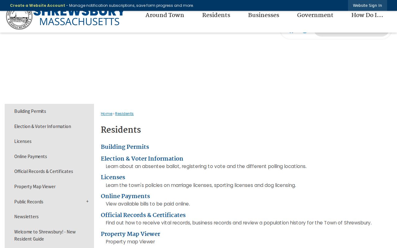
The captured Shrewsbury page supports careful civic navigation. For historical neighbors, the library and Historical Society can add dated material, but a historical source must still be tied to its year and collection.
Compare Shrewsbury Neighbor Sources
Official Shrewsbury and Worcester records have defined custodians, field meanings, and access limits. A parcel service identifies current mapped attributes. A Registry instrument documents a recorded land transaction. A Town Clerk route can provide only the public fields authorized for a municipal record. Commercial neighbor tools, by contrast, can combine dates, addresses, and names from sources with different update cycles and may not state which field was current or why a result was linked. Treat them as unverified discovery leads, not as proof.
| Source type | Strength for a Shrewsbury block | Limit to preserve |
|---|---|---|
| Official parcel or Registry source | Identifies a particular parcel or recorded land fact with a named custodian | Does not identify all people at an address. |
| Town civic source | Shows public representation, posted meetings, or a department contact | Does not create a private neighborhood membership list. |
| Library or historical source | Provides dated local context and finding aids | May be historical, incomplete, or a lead needing verification. |
| Commercial neighbor category | May surface a lead to verify independently | Accuracy, currency, source linkage, and lawful use can be unclear. |
For Shrewsbury neighbors, the practical rule is simple: check the exact official Shrewsbury record nearest to the fact and retain its date. Do not merge a name from one source with a parcel from another without at least one independent, lawful identifier.
Request Shrewsbury Block Records
Some Shrewsbury materials are available only through the correct department or a public-records request. Massachusetts Public Records Law is principally M.G.L. c.66, §10 and 950 CMR 32.00. A narrow request should identify the Shrewsbury department, parcel or road, date range, record series, and preferred format. Sharyn Thomas is the Shrewsbury Town Clerk and primary Records Access Officer at 100 Maple Avenue, 508-841-8507, sthomas@shrewsburyma.gov. The law generally calls for an initial response within ten business days, subject to clarification, extensions, fees, redaction, and the normal review process.
A sound request seeks an existing record, such as public building-permit entries for one Shrewsbury parcel during a stated period or town-meeting minutes mentioning a named road. Ask for segregable public portions where needed. Do not ask Shrewsbury to compile a block dossier, reveal confidential-voter fields, or locate an address that is protected by law.
Protect Shrewsbury Neighbors
Public data has firm limits. A Shrewsbury parcel owner is not necessarily the person at the property. A mailing address may be outside town. A voter-list omission does not prove nonresidence because status may be inactive, confidential, recently changed, or otherwise excluded. A court, permit, business, or license result has its own field meaning and cannot safely answer who lives next door. Use source labels such as live official result, database schema, indexed image, or public-records response.
Massachusetts protections include the Address Confidentiality Program under M.G.L. c.9A and 950 CMR 130.00, confidential-voter provisions, vital-record limits, and sealed, juvenile, expunged, or impounded court material. Do not try to reverse a protected or substitute address from a Shrewsbury parcel, voter, court, or license source. When a record is unavailable, that can be the legally correct result.
Lawful use. Use Shrewsbury neighbor and parcel records for lawful personal research, historical context, and civic transparency. Do not use any result to stalk, harass, harm, or circumvent a protected address.